WE’RE PUTTING GEOGRAPHY ON THE MAP
 Today, we have a regular need for geographic data, whether we’re using our knowledge of air currents to forecast the weather, predicting water currents to clean up an oil spill, safeguarding structures through historic information of earthquake hazards, or planning our educational
needs using forecasts of demographic change.
Geospatial technology is a growing field, and one of the most exciting industries today. In fact, the U.S. Department of Labor considers the field a high-growth industry and projects employment to increase 35 percent by 2020.
That’s where the Geographic Society of Chicago comes in.
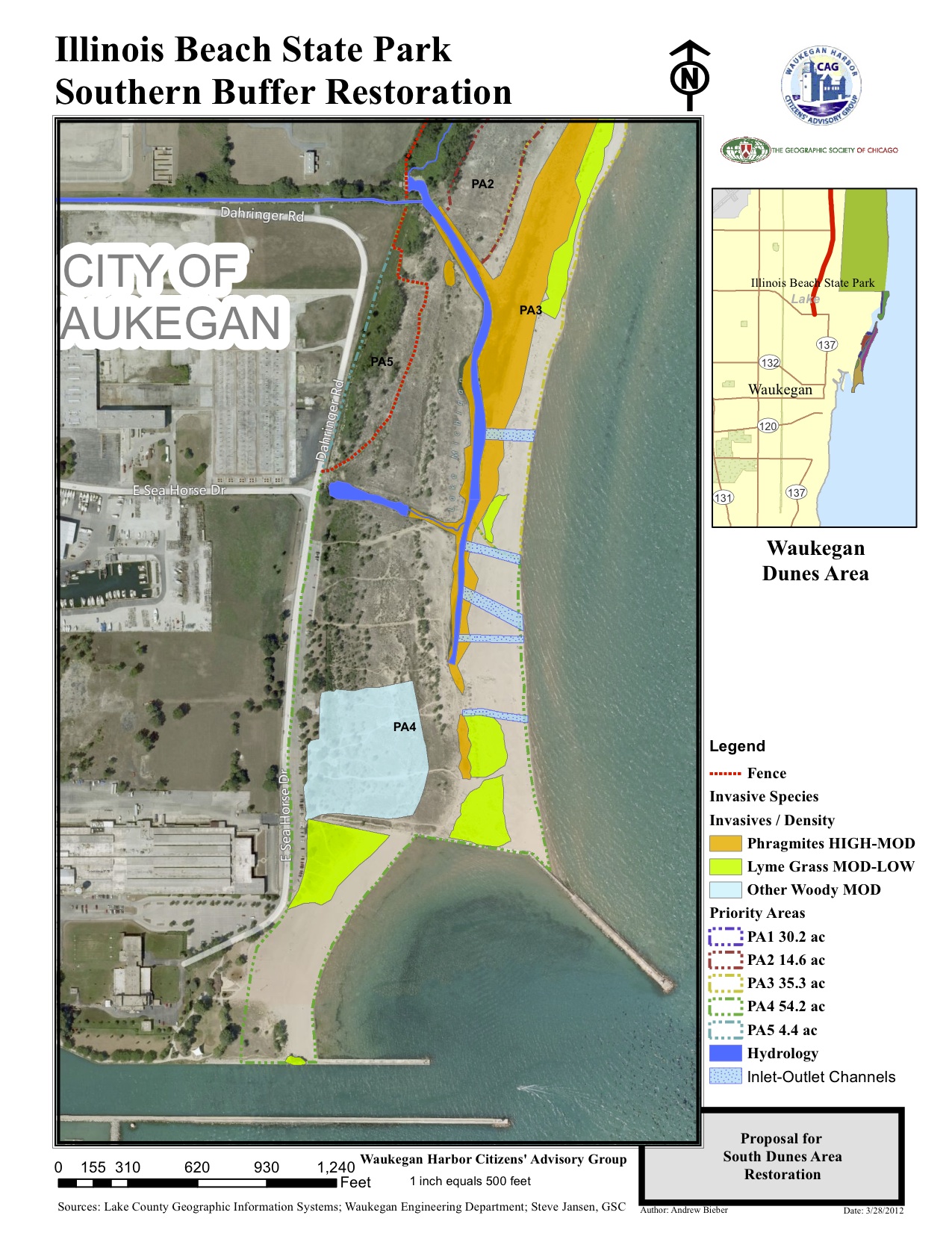
Our geospatial technology programs include not only Boys and Girls Clubs programs – where children receive hands-on experience and learn skills applicable to real-world employment – but also activities that help shape restoration projects and even map the movements of invasive species.
Want to learn more? Contact the GSC today!
GEOSPATIAL TECHNOLOGY TOOLS
GSC collects primary field data with its 20 hand-held GPS units, uploading the data to geographic information system (GIS) software with its laptop computer.
Thanks to a special license from Esri, the GSC uses the state-of-the-art ArcGIS platform for data analysis and display on maps. GSC’s license allows the Society to introduce K-12 students to the power of geospatial technology through the most prevalent and sophisticated GIS technology available in the market.
SERVICES
Fourth grade and older students learn the basics of this technology through custom-designed exercises. GSC gets students involved in their local community through projects such as mapping damaged sidewalk squares in urban settings, inventorying trees and garbage accumulation areas in local parks, and delineating invasive species for restoration work in natural areas. When one particularly creative high school math teacher wanted to reinforce the concept of grids, GSC had students use GPS units to create a grid on the football field and to spell out a message only viewable when uploaded and combined on a map in the cloud.
Geocaching is a fun family or camp activity that allows participants to immerse themselves in nature on a treasure hunt guided by GPS technology.
GSC’s partners gain initial access to powerful GIS software through GSC’s organizational license. For schools interested in continued use of the software, the GSC will assist in obtaining a license for the school and provide continuing support.
GSC’s staff will train your staff to collect field data, download data from published sources, combine and analyze data layers, and map the results.
The GSC provides mapping support for proposals, RFPs, and contract execution on federal, state, and local grants.
GPS unit rental is available to our partners who have received training in their use and wish continued support of their data analysis and mapping efforts.